What Verizon claims the tower would cover
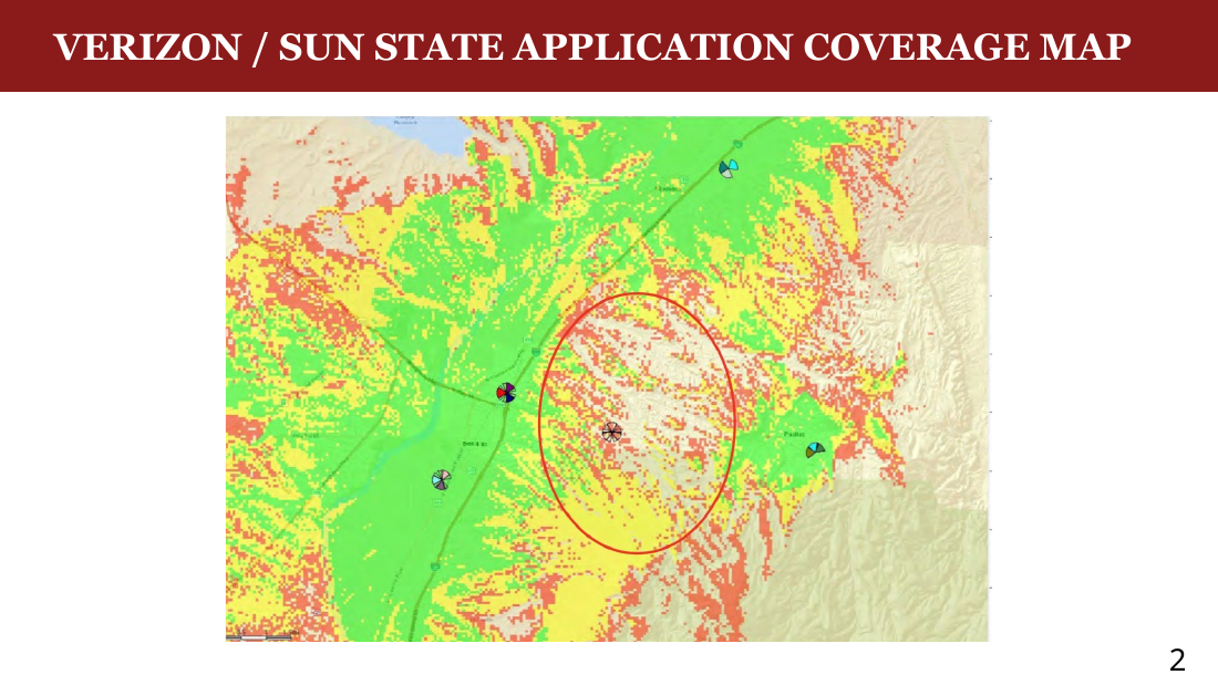
- The map on the left is from Verizon's own Application — the area Verizon says the proposed tower would reach.
- The Application says this shows Verizon's current coverage. “Coverage” is defined in the Application as areas “where service does not exist, calls drop, or ‘no service’.” The Application claims there is no Verizon service in most of the circled area.
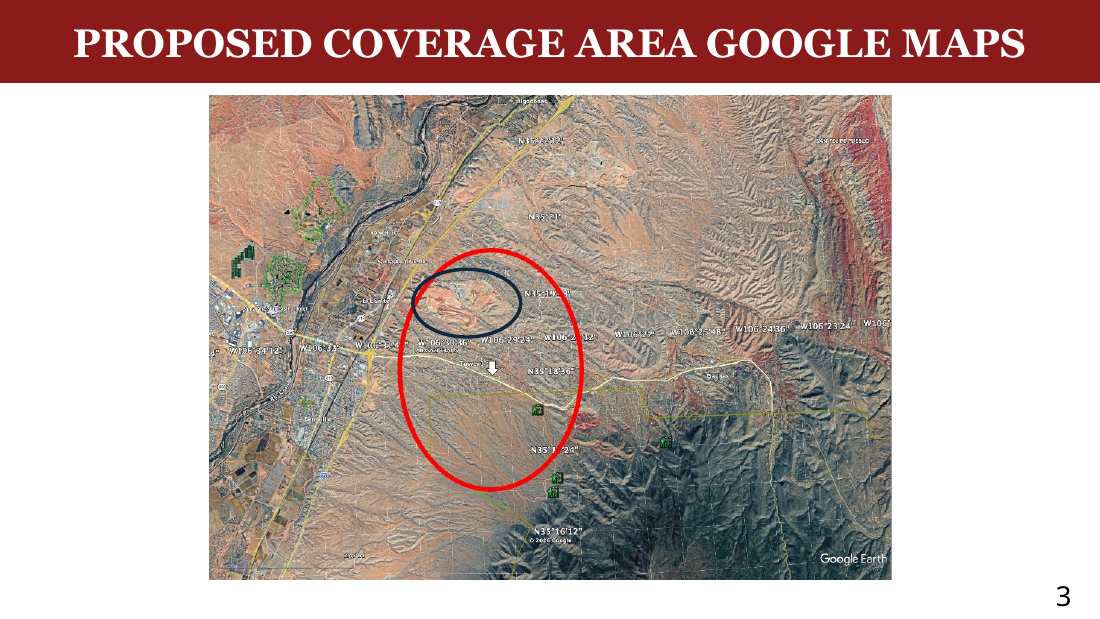
- The map on the right is the same circled area on a road map so you can see where this actually is. The proposed tower would only cover east to west from I-25 to the S curve, and north to south from the Open Space north of Sundance Mesa to the National Forest south of Placitas West. The large circled area within the circle is the gravel pit — a working mine where no one lives.
- The proposed coverage does NOT reach the communities east of the S curve — Las Huertas, Tunnel Springs, the Village, Diamond Tail. That's not opposition speculation; it's Verizon's own map.
What we actually measured on the ground
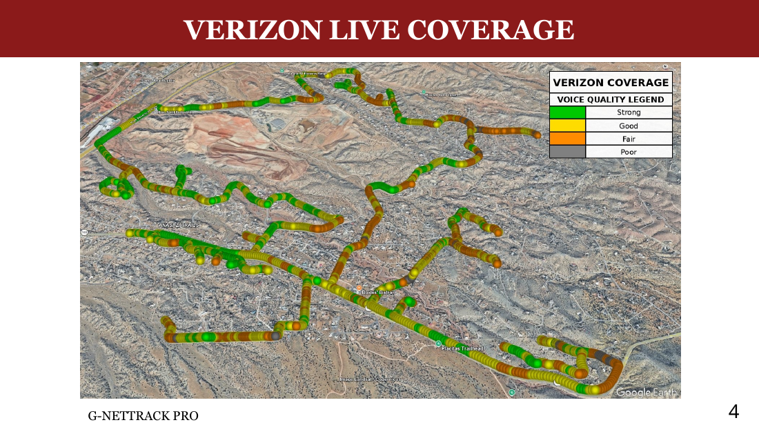
- We tested the Application's claim that there is no Verizon service in the circled area. Using G-NetTrack Pro, we drove through La Mesa, Sundance Mesa, Anasazi, Petroglyph Trails, Homesteads, Placitas West, NM-165 to the S curve, and Vista del Oro.
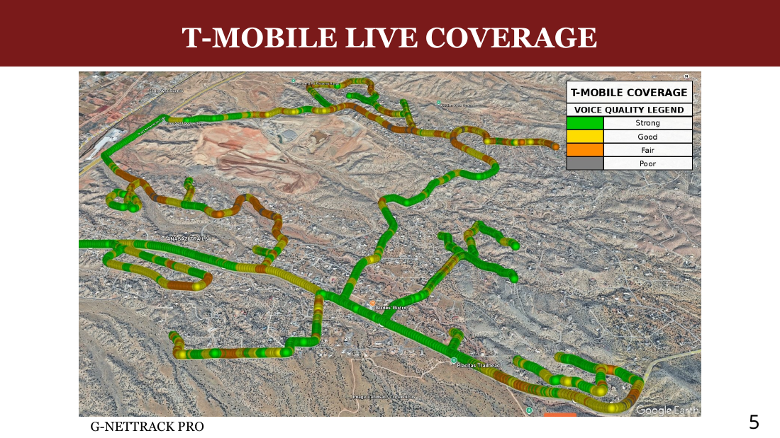
- The map on the left shows Verizon's signal on the drive. The map on the right shows T-Mobile's signal. Green measures strong voice signal. Yellow measures good voice signal. Orange measures fair voice signal. Grey measures poor voice signal.
- We had usable Verizon signal across the entire drive — and kept a live Verizon voice call running the whole way to confirm. We experienced only one dropped call the whole drive — at the lowest point on Camino Barranca.
- Coverage isn't perfect, but Verizon's claim of “no coverage” inside the circle is simply false.
- T-Mobile's signal was stronger in most areas — without a 75-foot tower at the gateway to Placitas. The natural question: where are all the T-Mobile towers?
So where are all the towers?
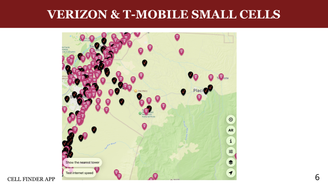
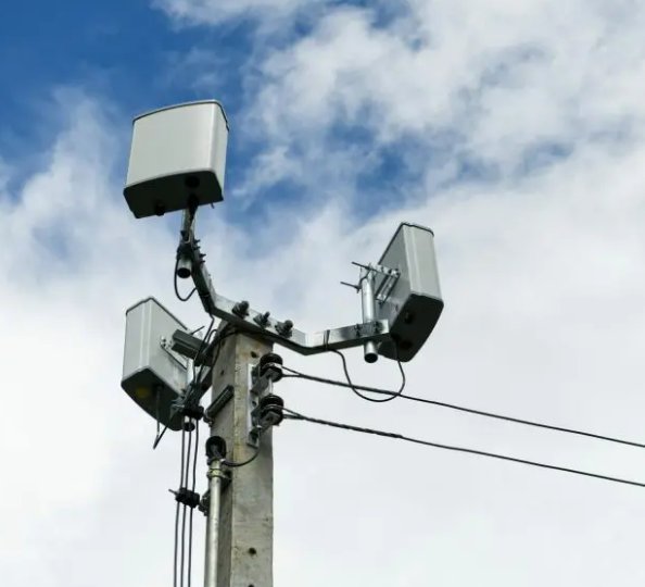
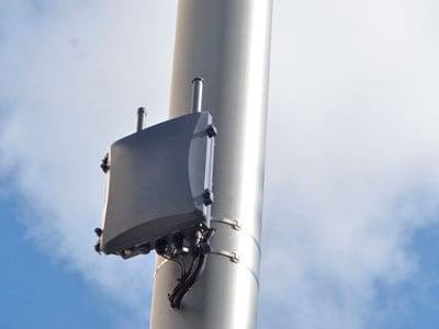
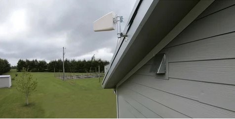
- The major carriers use small cell antennas to fill in coverage, including Verizon and T-Mobile. The black dots on this map are Verizon's small cells in Placitas. The pink dots are T-Mobile's.
- Small cells are microwave-sized devices attached to telephone poles, electric poles, homes, and water towers. They are virtually invisible — most residents never notice them.
- T-Mobile uses roughly three times more small cells in Placitas than Verizon does. That's why T-Mobile's signal was stronger on the signal test drive — without a 75-foot tower at the gateway to the community.
- Verizon could close its coverage gaps the same way T-Mobile already has — discreetly and respectfully, with infrastructure no one would see.
-
📡PDF ↓Coverage Analysis (Verizon's Submission)
Verizon's own coverage analysis filed with CU-26-001 — including the “Current Coverage” and “Proposed Coverage” maps, the carrier's stated coverage objectives, and the supporting RF claims used to justify the proposed site.